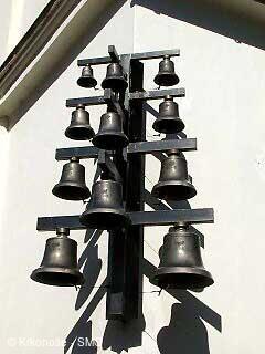
Zvonkohra Dolní Dvůr [ Bell tower or chimes ]


LOCATION
- WGS-84: 50.656388889N, 15.654444444E
- Altitude: 550.00 m
- Village or Town/City: Dolní Dvůr
- District of Administration 2: Vrchlabí
- District of Administration 3: Vrchlabí
- Region NUTS 4: Okres Trutnov
- Region NUTS 3: Královéhradecký kraj
- Region NUTS 2: Severovýchod
- Tourist region: 21 Krkonoše - střed
- Destination: Krkonoše
Type: Bell tower or chimes
LAST MODIFY: Michal Vávra (TO 21) org. 2, 11.10.2005 v 15:47 hodin